
Falmouth Street-by-Street Walkthrough
A by-street search in Falmouth works best as a record trail, not as a claim that everyone at an address is public. The Town of Falmouth Assessing record gives a parcel, situs address, owner name, physical details, sale reference, and other property facts. The GIS places that parcel among nearby lots. The Barnstable Registry then supplies the recorded ownership trail. A municipal voter-list request and a library street-list or directory can add a dated household clue when access rules allow it. Owners, non-owner occupants, trusts, estates, and seasonal occupants can be different people or entities.
- Search the address or street in Falmouth Assessing WebPro. Save the parcel ID, situs, owner spelling, book/page reference, sale information, and the date on the record.
- Open the parcel in the town GIS and turn on property boundaries. Check whether a large lot, condominium, or merged parcel changes how the street appears.
- Use the Registry name index to verify the owner’s recorded deed and legal description. Treat its address search only as a starting clue.
- For a dated voter question, request a specific street or precinct slice from the Falmouth Town Clerk under the Massachusetts Public Records Law, subject to protected fields and confidential-voter exclusions.
- For an older household, consult the Falmouth Public Library’s directory, Street List, newspaper, and map holdings for the year closest to the question.
Note: A result can show a property connection or a dated address clue, but it cannot prove every person currently living behind a door.
Falmouth Street Directory WebPro Searches
The Falmouth property-values office publishes its current assessment data through WebPro. The practical street tool is the Street Name field: a linked street name from a result can rerun a whole-street search. Add a house number, owner prefix, land-use code, neighborhood, value range, sale range, or construction detail when the result set is broad. The row can be sorted by parcel, location, owner, year and type, value, beds and baths, lot or finished area, land-use code, neighborhood, sale date and price, and book/page. FY2026 data is updated annually, with a value date of January 1, 2025 and new construction through June 30, 2025.
| WebPro field | Input or filter | Required | Falmouth use |
|---|---|---|---|
| Street Name | Search field | No | Find a named street; a linked street result reruns the full street. |
| Street Number | Search field | No | Narrows a street to one situs address. |
| Owner | Search field | No | Use prefixes and name variants for individuals, trusts, estates, or entities. |
| Parcel | Search field | No | Connects the assessor record to GIS geometry and deed references. |
| Land use, building, value, sale | Filters | No | Reduce a long result when the street name alone is too broad. |
The visible result row is not a household roster. WebPro can show several owners or trustees, and its mailing information may require opening the detail card or contacting Assessing. A mailing address is where tax correspondence goes. It is not proof that the addressee lives at the Falmouth parcel.
Falmouth GIS Street Layers
For the map step, use the legacy Falmouth GIS viewer or the town’s MapGeo viewer. The legacy search accepts Address, Owner Name, Street Name, Parcel ID, Acct #, Land Use Code, Mooring Number, Mooring Account, and Shellfish Areas. After selecting a street parcel, turn on the property layer and surrounding parcel lines. Voter precincts, zoning, historic, FEMA flood, regulatory, utility, aerial, marine, and vulnerability themes can add location context. The printable PDF map tool accepts a title, notes, and scale settings.
The legacy Falmouth GIS search interface shows the address, owner, street, parcel, account, and map-layer controls available for a street-directory search.
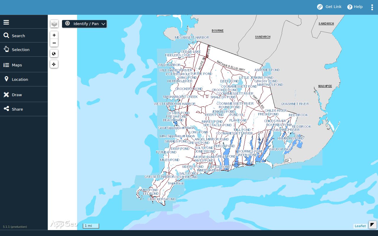
Map labels and parcel boundaries are useful leads, but the town’s GIS disclaimer says the data may be outdated or third-party. Confirm ownership through Assessing and recorded title through the Registry.
Falmouth Address Records by Street
The strongest Falmouth street-directory result combines several address-keyed records. Each has a different keeper and a different blind spot. The parcel and its legal reference form the bridge from a map label to a recorded land instrument. Permit files can date work, while a dated voter-list request may identify public registration data subject to exclusions. Historic directories may show an occupant or business, but they are not proof of title.
| Address record | Falmouth keeper | Street evidence | Access route |
|---|---|---|---|
| Assessing parcel card | Falmouth Assessing | Owner, situs, physical data, land use, sale and book/page references | Free WebPro, office, phone, or copy request |
| GIS parcel map | Falmouth GIS | Parcel geometry, adjacent lots, districts, and map layers | Free MapGeo or legacy viewer |
| Deed, mortgage, plan | Barnstable Registry of Deeds | Grantor, grantee, legal description, recording date, image, encumbrances | Free index and image view; clean image has a charge |
| Permit history | Falmouth departments | Address, parcel, applicant, owner, dates, status, inspections, attachments | PermitEyes or the responsible Records Access Officer |
| Local voter list | Falmouth Town Clerk | Public voter fields for a specific request, with exclusions | Specific paper or electronic records request |
| Directories and Street List | Falmouth Public Library | Dated occupants, businesses, and street context | Lemcke Reference Room and library resources |
Use a parcel ID to check whether a street address has changed lots, and use the deed’s legal description or plan when the street name does not match an older record. The street string alone is rarely enough.
Falmouth Recorded Deed Chain
The Barnstable County Registry of Deeds is the title-record custodian for Falmouth. Its records begin in 1742, and Land Court records begin in 1898. Nearly all indexes and images are online, except for stated very old records and some oversized plans. Massachusetts uses a name-based official index. The Registry does offer an address search, but expressly calls it a convenience search rather than an official index. Start with the WebPro owner and book/page, read the deed’s grantee and grantor names, legal description, plan references, date, and document number, then search the names backward.
The Registry public-access instructions show the free path to indexes and recorded images.
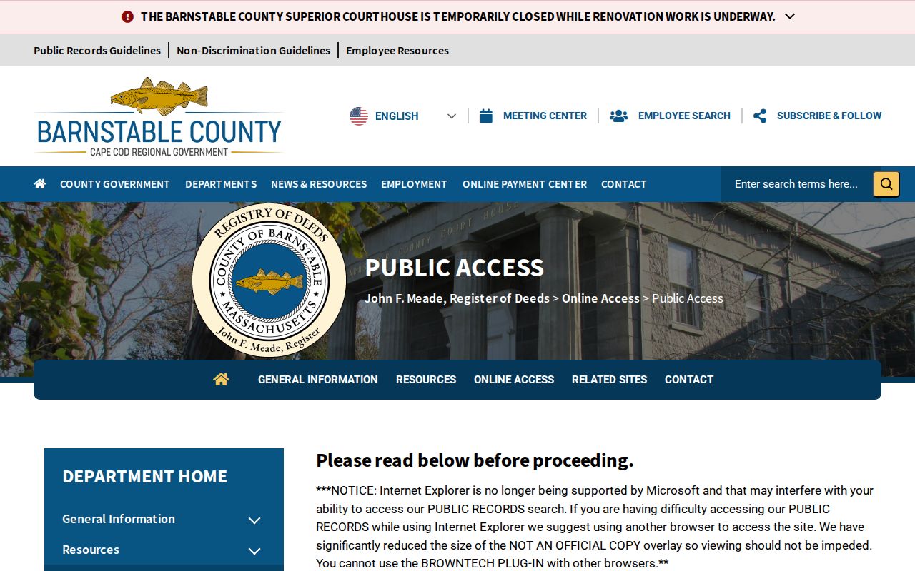
A downloaded research image carries a “not an official copy” overlay. A clean image costs $1 per page, with the listed card convenience fee. When an image or plan is missing, use the Registry counter, staff, deed books, microfilm, plans, or a title examiner rather than assuming the chain ends.
Falmouth Address Permit Dates
Falmouth PermitEyes is a no-login public view for Building, Health, Conservation, Planning/Historic, and ZBA activity. Its address-history information can include parcel number, street number and name, applicant, owner, application and issue dates, permit number, application type, brief description, inspections, certificate of occupancy status, and attachments. That makes it useful for placing an alteration, inspection, or planning review on the same street timeline as a deed. An applicant may be an agent or contractor, so the name is not a residence claim or title confirmation.
Most Health files in the public database were submitted after August 8, 2022. For an earlier Health file, the town directs requests to health@falmouthma.gov. The Falmouth public-records form can also route a request to the appropriate department when a record is not visible online.
Note: Permit activity can date a building change, but it does not identify every household member or establish a complete ownership chain.
Falmouth Voter Requests by Street
The Massachusetts individual voter-status tool is not a browse-by-street directory. It requires a first name, last name, full date of birth, residential ZIP, and an agreement checkbox, then reports status, polling place, and elected officials for that submitted identity. For a public street-level question, the documented route is a specific request to the Falmouth Town Clerk under the Massachusetts Public Records Law. Ask for a date, street or precinct, format, and the existing fields needed. The statewide voter file is not a public record.
Public local-list fields can include name, address, party designation, date of birth, active or inactive status, and voter ID. Phone, email, veteran status, permanent absentee status, confidential-voter information, and minor or pre-registrant records can be withheld. A confidential voter is not an error in the Falmouth street directory. The Annual Street List and voter status also change over time, so preserve the record date.
Falmouth Historic Street Evidence
Older Falmouth street evidence lives in selected years, not in one continuous reverse directory. The Falmouth Public Library holds Bourne, Falmouth and Sandwich directories for 1900 and 1903; State Library and National Archives references identify later years including 1908, 1926, and 1929. The library also holds Blue Books for various years from 1908 through 1937, a Falmouth Street List from 1980 forward, and Sanborn maps for 1901, 1906, 1914, 1923, and January 1930 through September 1942. Read the alphabetical and street portions of a volume when they exist.
The historical volumes themselves belong to the Falmouth city directory collection trail. For an address question, use a year near the event, then pair an occupant entry with a map, parcel plan, deed, or census household. Blue Books can reflect seasonal residents and resort communities, so they are not a substitute for a year-round census.
Falmouth Village Address Labels
Falmouth addresses may carry a village label that does not behave like a single townwide ZIP. Falmouth Village, East Falmouth, Falmouth Heights, North Falmouth, Hatchville, Silver Beach, Teaticket, Wequoit, West Falmouth, and Woods Hole all appear in local geographic material. The county’s village list pairs them with postal ZIPs, while the Registry and assessor records rely on town, parcel, legal description, and recorded instrument details. A historic directory can use “Falmouth Village” or “Woods Hole” where a modern search expects a standardized street form.
Use the town road atlas, historic-district maps, the 1880 and 1910 atlases, a 1909 road-index map, and parcel geometry to bridge labels. Main Street was laid out in 1687, but no official source found a Falmouth-wide street-renumbering year. Do not invent one when an exact modern address search fails.
- Parcel
- An assessor identifier for a piece of land. It links the property record to mapped geometry, but it is not a postal address.
- Situs address
- The physical location of the parcel. It can differ from the owner’s mailing address for tax correspondence.
- Plat or plan
- A recorded map or plan that describes lots and boundaries. It can bridge an old street label to a current parcel.
- Criss-cross directory
- A directory section arranged by address or street rather than only by a person’s name. Its contents must be checked in the actual volume.
Falmouth Land Records Since 1742
Falmouth has an unusually long recorded land trail because Barnstable property records begin in 1742 and Land Court records begin in 1898. That depth does not make every address simple. The annual WebPro record is best for a current parcel and assessment snapshot, while the Registry provides title instruments and legal descriptions. The library fills household and physical-place gaps through selected directories, newspapers, Street Lists, atlases, old-house materials, and Sanborn maps. Falmouth library documents dating back to 1792 were rebound and digitized through a Community Preservation Fund project, adding another local history channel.
This sequence matters when a street search crosses formats: a modern parcel can lead to a nineteenth-century deed, a twentieth-century map, and a library volume. Preserve the spelling, village label, parcel number, and date from each record. Those details are stronger than forcing a name or address into a later form.
Note: The Registry’s 1742 beginning describes property-record coverage, not a promise that every historic image, plan, or modern street label is complete online.
Falmouth Street Directory Privacy Limits
A street record does not disclose everyone who lives at an address. Renters and household members may never appear in the property roll. Exact DMV addresses are protected by the Driver’s Privacy Protection Act. Utility customer names and consumption, private library and school-user records, protected-voter addresses, Address Confidentiality Program locations, and sealed or juvenile court materials are not ordinary street-search fields. A homestead filing or listed owner can support a property connection, but it cannot identify a complete household.