
Falmouth Neighbors by Block
Falmouth neighbors can be researched one adjacent parcel at a time. Start with a property map to see the block, then use the property card and recorded deed for each selected lot. That sequence identifies a parcel owner or a named party on a document. It does not create a list of occupants. A municipal voter-file request, permit record, historical street list, or public community organization can add limited context, but each has a different keeper and a different privacy boundary.
| Source | What It Shows About a Block | Access |
|---|---|---|
| MapGeo or legacy GIS | Parcel boundaries, adjacent polygons, layers, districts, and property links | Free public map; data carries a verification disclaimer. |
| Falmouth WebPro | Owner of record, parcel card, situs, physical details, and sale references | Free search by owner, street, parcel, and address fields. |
| Barnstable Registry | Recorded parties, legal descriptions, plans, and title relationships | Free index and research images; official verification remains with the Registry. |
| Local voter list | Allowed public voter fields at local addresses | Specific request to Falmouth Town Clerk; confidential voters are omitted. |
| PermitEyes | Address work history, named owners or applicants, inspections, and certificates | Public, no-login view; older Health records have a stated gap. |
| Public community resources | Public contacts, meetings, neighborhood history, or local programs | Town links and organization channels, not private member lists. |
The first three sources provide the best Falmouth block foundation because they can be checked against the same parcel and legal description. A property owner may be a trust, estate, business, or person who receives mail away from the lot. Treat every owner name as a record fact, not proof that the person is one of the neighbors now living on the block.
Falmouth Block Parcel Records
The Town of Falmouth's MapGeo parcel viewer is the starting point for the immediate block. Search an address or parcel ID, select the mapped polygon, and zoom to the street segment. Keep the property layer and parcel boundaries visible, then use the identify or location tools to select adjoining polygons. The viewer can also provide a fixed block image through its PDF map creator. Zoning, flood, historic, voter-precinct, utilities, aerial, water or sewer, marine, and vulnerability layers give context, but they do not establish title or who occupies a property.
The MapGeo configuration warns that public map data is not a substitute for official Registry records. For Falmouth neighbors, use the selected polygon as an index clue, then verify the related owner in WebPro and a title question in the Registry. The legacy public GIS is also useful when its address, owner, street, parcel, account, land-use, or mooring search fits the question.
The Falmouth MapGeo viewer shows the public parcel-map environment used for a block search.
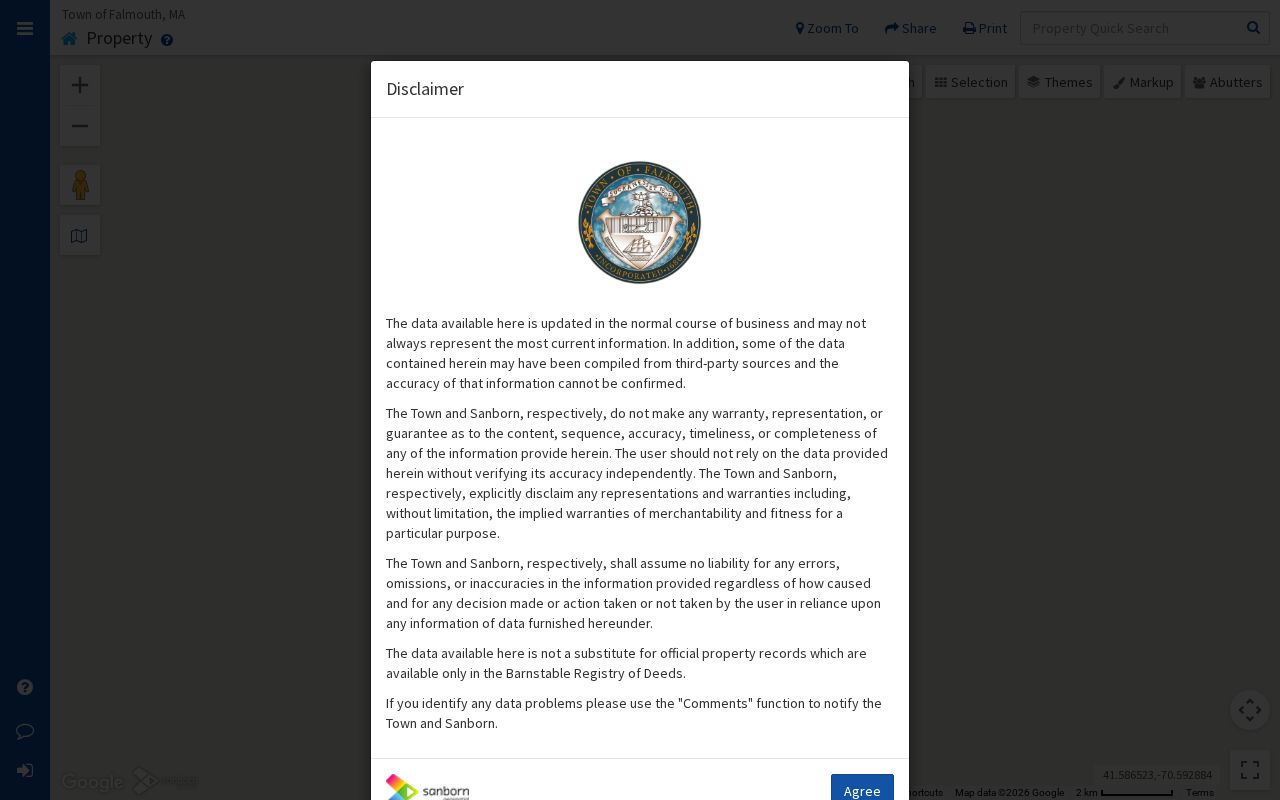
Use a selected Falmouth parcel to orient the search, then capture the parcel identifier before moving to owner and deed records. Map geometry is useful context, not a final identity answer.
Falmouth Neighbors Need Town Map Context
Parcel boundaries explain only part of a Falmouth block. The town's map collection adds road-atlas, historic, voter-precinct, school, flood, zoning, and road-map context. That material can clarify a village label, a district line, or the relation between a current parcel and an older street reference. It does not create a list of people on the block. Pair a map layer with the parcel identifier and the dated record that supports the particular question.
The Falmouth Town Maps collection provides the municipal map source shown below.
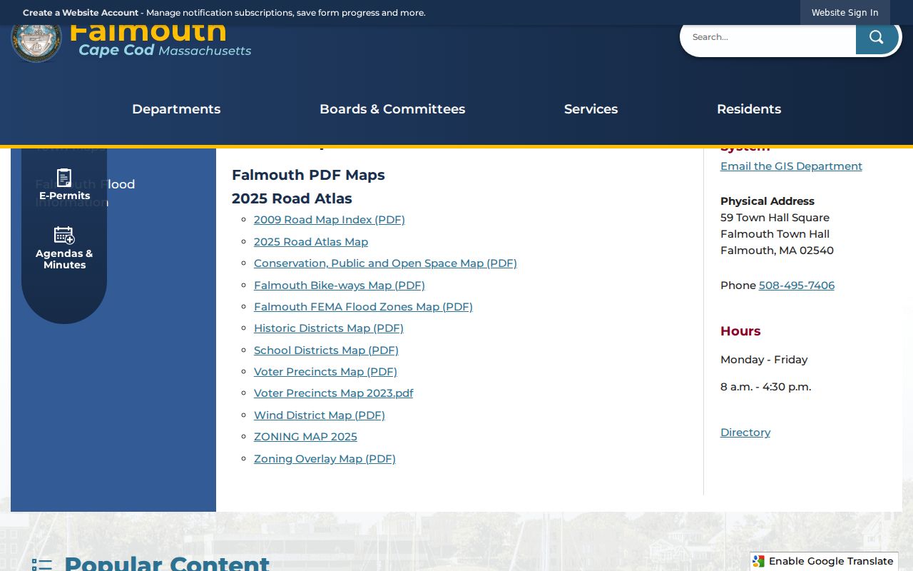
A Falmouth map can place a block within a precinct or historic area, while WebPro and the Registry remain the sources for property-record verification.
Mapping Falmouth Neighbors by Parcel
Work outward from one Falmouth address in a small, repeatable chain. The goal is to compare adjoining parcels, not to sweep an entire street or turn a map into a household roster. The parcel ID, physical parcel address or situs, legal description, book or page reference, and deed parties give the strongest handoff between the map, assessment, and Registry systems. When a Falmouth lot has been split, merged, or recorded under a trust or estate, those identifiers are more dependable than a street label alone.
- Locate the Falmouth address or parcel ID in MapGeo or the legacy GIS and select the subject polygon.
- Keep parcel boundaries on, click each adjoining polygon, and note the situs and parcel ID before opening another record.
- Search the selected parcel in WebPro to compare the recorded owner, physical parcel details, sale reference, and available property card.
- Use the owner or grantee name, legal description, book, page, document number, or plan reference in the Barnstable Registry.
- Separate a recorded owner from any inference about current occupants, then retain the date of every Falmouth result.
A long named-street investigation uses a broader sequence of street search, parcel records, permits, deeds, and local records. The Falmouth street directory carries that full street-by-street method; this block workflow stays with the parcels immediately around one address.
Falmouth Block Owner Records
Falmouth WebPro searches by parcel, owner, street name or number, account, and property characteristics. Its results can be sorted by parcel, street, owner, year or type, total value, beds and baths, lot or finished area, land-use code, neighborhood, sale date or price, and book or page. A clickable street name can rerun a whole-street search, but a tight Falmouth neighbors review should add a number or parcel when the street result is too broad. Open the property record card when the summary row does not answer the question.
Falmouth WebPro's annual data date matters. The inspected FY2026 data uses a January 1, 2025 value date with new construction through June 30, 2025. Its situs address is the parcel's physical location. A mailing address is where tax correspondence goes, and can belong to an out-of-town owner, trust, business, estate, or another contact location. A homestead notation may support owner-occupancy evidence but does not identify everyone in a household.
Note: A Falmouth property card identifies a parcel relationship, not a complete current list of neighbors or household members.
Falmouth Neighbors and Voter Lists
The Massachusetts individual voter-status tool cannot browse a Falmouth block. It requires a submitted first name, last name, full date of birth, residential ZIP, and agreement checkbox, then returns the submitted person's registration or pre-registration status, active or inactive status, polling place, and elected officials. The form is for individual status confirmation. It is not a neighborhood directory and should not be repeated as a way to discover the people around an address.
A local public voter-list request is the lawful block-level route when a particular record is needed. The Secretary says public local fields can include name, address, party designation, date of birth, active or inactive status, and voter ID. Some additional history may be available on request. Phone, email, veteran status, permanent absentee status, confidential-voter records, and minor or pre-registrant records can be withheld. The statewide voter file is not public. Send the Falmouth Town Clerk a specific request for a street, precinct, year, format, and delivery method, then ask about current production cost.
Falmouth Block Permit Records
Falmouth PermitEyes adds an address-based chronology to a block search. Its public view can show application, permit, inspection, certificate of occupancy, parcel, street, owner, applicant, description, status, and attachments. Building, Health, Conservation, Planning or Historic, and ZBA records can date construction, alterations, zoning review, septic or health work, or a change of responsible person. These entries are useful for understanding activity at a Falmouth address, but an applicant is not necessarily an owner and a permit does not prove residency.
Falmouth states that most Health records in the database are files submitted after August 8, 2022. For earlier Health material, the documented route is an email request to health@falmouthma.gov. For another department's record, the town public-records process can route a specific request to the relevant custodian. Keep a Falmouth permit date separate from a deed recording date because the two document different events.
Falmouth Neighbors Through Associations
Falmouth's public community layer is useful for learning about a village or a civic issue, not for obtaining a private household list. The town's Villages quick-link page names the Falmouth Heights-Maravista Improvement Association, Woods Hole Business Association, Woods Hole Community Association, and Woods Hole Historical Museum. Town materials also point to FACES, Friends of Falmouth Dogs, The 300 Committee, Coalition for Buzzards Bay, Oyster Pond Environmental Trust, and Salt Pond Areas Bird Sanctuaries. Public meetings, contact pages, and exhibits can provide Falmouth neighborhood context.
| Falmouth community resource | Public path | Appropriate use |
|---|---|---|
| Falmouth Heights-Maravista Improvement Association | Town Villages quick links and its public channels | Community information and public contact, not a member roster. |
| Woods Hole Community Association | Town quick links and organization contact | Village events and civic context, not household verification. |
| Woods Hole Business Association | Town quick links and public business materials | Business-community context, not residential identity. |
| FACES and environmental groups | Town-linked organization pages and public meetings | Public project and neighborhood-area context. |
The official Falmouth links are an umbrella resource, not a promise that any group publishes members. No official public member roster was located for these associations. Contact an organization through its public channel or attend a public meeting rather than assuming community participation reveals personal address information.
The Falmouth Villages page is the source for these public association links.
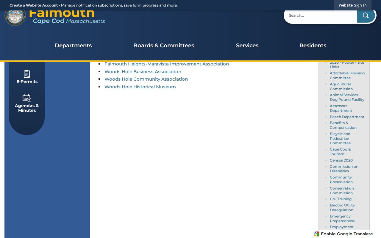
Use these Falmouth resources to understand the community around a block, while keeping private membership and household details out of the search.
Falmouth Neighbor Records Since 1742
Falmouth block research often crosses more than one era. Barnstable Registry property records begin in 1742, and Land Court records begin in 1898. Nearly all Registry indexes and images are online, with stated exceptions for some very old material and oversized plans. The Registry's address search is a convenience tool, not its official index. A title question still needs names and legal descriptions checked against the recorded instrument. For a Falmouth block with older lots, maps, plans, and adjoining legal descriptions can bridge a street label that has changed or a parcel that was divided.
The town's village geography adds another layer. Falmouth Village, Falmouth Heights, East Falmouth, Teaticket, Wequoit, North Falmouth, West Falmouth, Woods Hole, Hatchville, and Silver Beach can appear differently in historical sources. Falmouth's Main Street was laid out in 1687, and maps, historic districts, voter precincts, aerials, and Sanborn sheets supply useful block context. They do not turn historical evidence into a current-neighbor list.
Falmouth Neighbor Source Comparison
Official Falmouth records and commercial neighbor-lookup categories serve different purposes. A parcel map, property card, recorded deed, and municipal voter response have named custodians and known access rules. Commercial profiles commonly combine property, voter, licensing, marketing, and other fragments. They can merge people with the same name, retain an old address, omit protected people, or leave out the date and custodian needed to verify a claim.
| Official Falmouth record path | Commercial neighbor-profile category |
|---|---|
| Names its office, record type, date, and access rule. | May combine sources with unclear timing, coverage, or identity matching. |
| Allows a parcel, deed, docket, or request to be checked with its custodian. | Can suggest a connection but does not make it an official fact. |
| Protects confidential voters, restricted records, and other excluded data. | May be stale, incomplete, or unable to show why a person is missing. |
For Falmouth neighbors, use a commercial category only as a possible spelling or address lead, then return to the map, WebPro, Registry, Town Clerk, or other actual custodian. Do not treat a paid result as more authoritative than the record it claims to summarize.
Note: A record with a known custodian and date is stronger than a profile with an unexplained match.
Falmouth Neighbor Lookup Privacy
Falmouth neighbor research has firm boundaries. Property sources may identify a recorded owner, but they do not reveal every renter, household member, utility or delivery customer, school user, or private association member. The Massachusetts Address Confidentiality Program provides a substitute address and confidential-voter handling for qualified participants. Confidential voters are omitted from public lists. Do not try to reconstruct a protected location from parcel, voter, court, or mailing details.
Massachusetts also limits DMV personal information, restricted vital records, sealed or impounded court records, and some voter fields. A missing name can reflect privacy protection, a record date, a move, an estate, a trust, or a source that never indexed occupants. If a Falmouth record is wrong, ask its custodian about the correction process and provide the documentation it requests.
Lawful use. Use Falmouth neighbor records for personal, lawful community and property questions. Never use a map, record, or public contact to stalk, harass, intimidate, or expose anyone.